
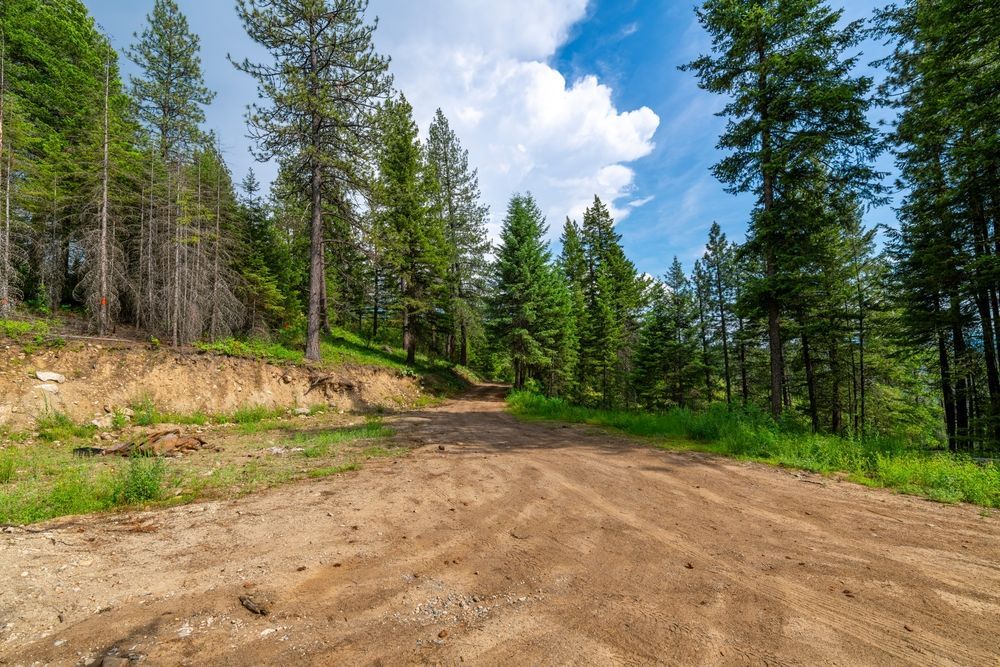
Paths Defined Without Excess Disturbance
Trail Clearing & Access Road Cut in Germantown for recreational access routes and property boundary line establishment
Hunting access, ATV routes, and drivable pathways through wooded acreage require precise clearing that creates usable corridors without disturbing adjacent vegetation or causing erosion on sloped terrain. Rural landowners across Preble, Darke, Greene, and Warren counties rely on defined trails for equipment movement, livestock management, and recreational use, but overgrown properties lack the clear pathways needed for tractor passage, boundary line visibility, or seasonal hunting access. ClearCut cuts narrow-width trails and access roads that preserve surrounding timber and minimize soil disturbance while creating drivable routes for quads, UTVs, tractors, and pickup trucks across properties where full-width clearing would be excessive and environmentally damaging.
Trail clearing creates controlled-width corridors by removing vegetation within a defined footprint—typically eight to twelve feet wide for ATV trails or twelve to sixteen feet for light vehicle access—while leaving root systems and adjacent trees intact to prevent erosion and maintain habitat continuity. The process involves cutting saplings and brush, grinding stumps flush with grade, and smoothing the trail surface enough for vehicle passage without the grading and aggregate base required for permanent driveways. Property owners use these trails to access remote sections for timber management, food plot establishment, or fence line maintenance that would otherwise require long hikes through dense cover.
Arrange a site walk to review proposed trail routes, terrain challenges, and vehicle clearance requirements.
Why Narrow-Width Clearing Works for Property Access
Precision trail cutting begins with walking the proposed route to identify obstacles, evaluate slope stability, and mark trees or features requiring avoidance. Equipment processes vegetation within the defined corridor width, leaving side slopes and adjacent timber undisturbed to maintain erosion resistance and wildlife cover. On properties with significant elevation changes, trail routing follows contour lines or incorporates gentle grades to prevent rutting and water channeling during wet seasons, which is particularly important in Southwest Ohio where spring rains and clay soils create challenging trail conditions.
Once the trail is cleared, you drive an ATV, tractor, or side-by-side directly to remote property corners, hunting stands, or management areas without navigating around fallen logs or pushing through overgrown saplings. The cleared corridor remains visible throughout the growing season, simplifying navigation and reducing the risk of getting turned around on large parcels. Property boundary trails make fence inspection and repair practical, allow yearly monitoring of timber health and invasive species encroachment, and provide emergency vehicle access for wildfire response or medical situations on properties far from public roads.
Trail clearing establishes the pathway but does not include gravel placement, culvert installation, or drainage engineering required for all-weather vehicle access. If your route crosses wet areas, low spots that pond water, or steep sections prone to washout, additional work involving aggregate base, water bars, or culverts becomes necessary to maintain year-round usability. Basic trail clearing provides dry-season access and defines the route for future improvements as usage patterns and maintenance needs become clear..
Common Questions About This Service
Agricultural and recreational landowners in rural counties typically ask about durability, maintenance, and route planning before trail projects begin.
What width trail do I need for different vehicles?
ATV and side-by-side access requires eight- to ten-foot clearing width; pickup trucks or tractors need twelve to sixteen feet depending on wheelbase and whether you need room for mirrors and side clearance on trails with standing timber.
How do you prevent trails from becoming muddy ruts?
Route selection avoids natural drainage channels and low spots where water collects; on unavoidable wet sections, the trail surface is crowned slightly or aggregate base is added to shed water and provide firm footing during spring thaw and rainy periods common in Germantown-area clay soils.
Can trails be cleared to follow property lines exactly?
Boundary-line trails are cleared based on survey pins or marked lines; precision depends on accurate boundary identification before clearing begins, and landowners typically have lines surveyed or marked by a forester if exact placement is critical for fence installation or timber sale boundaries.
Will cleared trails grow back quickly?
Trails maintained by regular vehicle traffic stay relatively clear; unused trails begin to sprout saplings and brush within one growing season, and periodic mowing or re-clearing every two to three years is necessary to maintain defined corridors without repeated heavy equipment use.
How much does trail clearing cost per mile?
Cost depends on vegetation density, terrain difficulty, and trail width; straight, level trails through light brush cost significantly less per mile than winding routes requiring stump grinding, slope stabilization, or navigation around wetlands and rock outcroppings.
ClearCut serves rural properties throughout a five-county area where hunters, farmers, and recreational landowners need defined access without the cost and environmental impact of full-scale road construction. Contact ClearCut to walk proposed routes, discuss seasonal access needs, and develop a clearing plan that balances vehicle requirements with terrain constraints and budget considerations.